Best Korean Subway Apps for Foreign Tourists

Korea’s subway system—especially Seoul’s—is one of the most efficient, clean, and tourist-friendly metro networks in the world. But with over 20 lines crisscrossing the capital and neighboring cities, even the clearest signage can’t replace a good navigation app on your phone. The right app turns a potentially overwhelming journey into a simple tap-and-go experience, showing you exactly which line to take, where to transfer, and how much time you’ll need.
Here’s a practical breakdown of the best subway apps for international visitors, what makes each one useful, and which one will actually work best for your trip.
Kakao Metro: The Local Favorite with Full English Support
Kakao Metro (formerly Subway Korea) is the most popular subway app among both locals and expats, and for good reason. It covers the entire Seoul metropolitan area plus Busan, Daegu, Daejeon, and Gwangju—basically every major city with a metro.
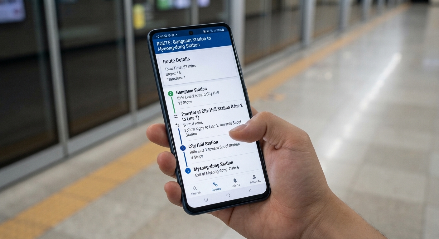
The app shows real-time train arrival times, calculates the fastest routes, and tells you which subway car to board for the quickest transfer or exit. That last feature is a game-changer when you’re rushing to catch a connection at a massive station like Gangnam or Seoul Station.
Key Features
- Real-time arrival information updated every few seconds
- Car position recommendations (e.g., “board car #7 for fastest exit”)
- Full English interface with station names in both Korean and romanized text
- Offline mode for route planning (though real-time data requires internet)
- Fare estimates for every journey
The app is completely free with occasional banner ads that don’t interfere with usability. It works offline for basic routing, but you’ll need data or Wi-Fi for live train times.
Naver Map: All-in-One Navigation Beyond Just Subways
If you want more than subway directions, Naver Map is Korea’s equivalent to Google Maps—but much more accurate and detailed for Korean addresses, businesses, and transit.
Naver Map includes subway routing with real-time data, but it also integrates buses, walking directions, and even bicycle paths. The app knows Korea’s quirky address system and can find obscure alleyway cafés that Google Maps misses entirely.
When Naver Map Beats Subway-Only Apps
- You’re combining subway rides with bus connections or walking
- You need to find specific building entrances or exits (Korean addresses can be confusing)
- You want restaurant, café, and attraction info tied directly to transit directions
The interface is fully available in English, and route cards clearly show transfer points, walking times between platforms, and which exit to use. The learning curve is slightly steeper than Kakao Metro, but it’s worth it if you plan to explore beyond the main tourist zones.
💡 Tip: Naver Map works best with a Korean data connection. Download the app before you arrive and test it with Wi-Fi to get familiar with the interface.
Subway Korea (Web Version): No Download Needed
If you’d rather not install another app, the Subway Korea website (subwaykorea.co.kr) offers a mobile-friendly route planner that works directly in your browser. It’s bare-bones compared to the apps—no real-time arrivals, no car position tips—but it calculates routes accurately and shows transfer stations and total travel time.
This is a solid backup option if your phone storage is tight or you’re only making a couple of subway trips during your visit. Bookmark the English version before you go, and it’ll load quickly even on slower hotel Wi-Fi.
Comparing the Top Options
| App / Tool | English Support | Real-Time Arrivals | Offline Routing | Coverage | Best For |
|---|---|---|---|---|---|
| Kakao Metro | Full | Yes | Partial | All major cities | Dedicated subway navigation |
| Naver Map | Full | Yes | Limited | Nationwide | Multi-modal trips (subway + bus + walking) |
| Subway Korea Web | Full | No | No | Seoul metro area | Minimal app installs |
| Google Maps | Full | Limited | Yes | Nationwide | Familiarity (less accurate in Korea) |
What About Google Maps?
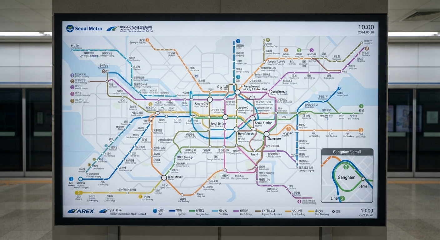
Google Maps does work in Korea for subway routing, and the interface will be familiar if you’ve used it in other countries. But it lags behind local apps in three important ways:
- Route accuracy: Google sometimes suggests slower routes or misses optimal transfers.
- Real-time data: Updates are less reliable than Kakao Metro or Naver.
- Local business listings: Many smaller shops, restaurants, and exits don’t appear or have incorrect pins.
If you’re only visiting Seoul’s main tourist areas (Myeongdong, Hongdae, Gangnam) and sticking to simple point-A-to-B trips, Google Maps will get the job done. For anything more complex, you’ll want a Korean app.
Practical Tips for Using Subway Apps in Korea
Get a T-money card or Cashbee card before you start riding. Apps calculate fares, but you’ll still need a rechargeable transit card to tap in and out at gates. These cards work across all subway lines and buses nationwide.
Download your app and test it before departure. Most airports and tourist areas offer free Wi-Fi, but coverage can be spotty in some neighborhoods. Offline routing in Kakao Metro works without a connection once the app is installed and you’ve loaded the map data.
Check the last train times. Seoul’s subway typically runs until around midnight on weekdays and 1 AM on weekends, but this varies by line. All the apps show first/last train schedules—double-check before a late-night outing so you’re not stranded.
Use the exit number feature. Major stations have 10+ exits, and choosing the wrong one can add 5-10 minutes of walking. Apps like Kakao Metro and Naver Map show which exit gets you closest to your destination.
Which App Should You Actually Download?
For most tourists, Kakao Metro is the single best choice. It’s laser-focused on subway navigation, fast, intuitive, and packed with features that make transfers and timing effortless.
If you’re staying longer, exploring beyond Seoul, or planning complex trips that mix subways, buses, and walking, add Naver Map to your phone. The two apps complement each other well and together cover nearly every navigation scenario you’ll encounter.
Skip the web version unless you’re extremely tight on storage or only making one or two trips. And while Google Maps is fine as a fallback, relying on it exclusively means missing out on the precision and real-time accuracy that make Korean subway apps so useful.
Download one (or both) before you land, load them up with your hotel and sightseeing destinations, and you’ll navigate Korea’s metro like you’ve lived there for years.